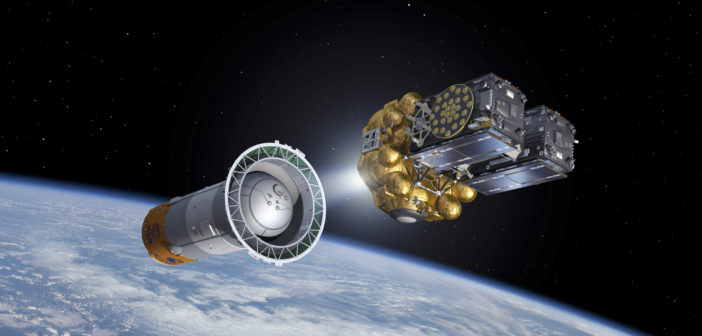
Seventeen years and more than 10 billion euros ($11 billion) later, Europe’s Galileo satellite navigation system is set to go live on Thursday, promising to outperform US and Russian rivals while boosting regional self-reliance.
Initial services, free to use worldwide, will be available only on smartphones and navigation boxes already fitted with Galileo-compatible microchips.
Some devices may only need a software update to start using the new technology, and European Commission spokeswoman Mirna Talko said several smartphone giants were already making chips compatible with it.
“It will be the first time that users around the world will be able to be guided by Galileo satellites,” said Lucia Caudet of the Commission, which funds the project.
Somewhat fuzzy at first, the signal will be boosted with help from satellites in the US military-run GPS system, growing stronger over time as orbiters are added to the now 18-strong Galileo network circling 23,222 kilometres (14,430 miles) above Earth.
According to its proud parents, the Commission and European Space Agency (ESA), Galileo should be fully operational by 2020, providing time and positioning data of unprecedented accuracy.
“GPS allows a train to know which area it is in—Galileo will allow it to identify the track it is on,” according to Jean-Yves Le Gall, president of France’s CNES space agency, one of ESA’s 22 country members.
Such precision would also be invaluable for safer driverless cars and nuclear power plants, as well as better telecommunications.
The civil-controlled service is also of great strategic importance for Europe, which relies on two military-run services—GPS and Russia’s GLONASS, which provide no guarantee of uninterrupted service.
It will be inter-operable with these, but also completely autonomous. “Having a system that is somewhat independent of the US system that is controlled by the military is probably a good thing,” explained George Abbey, a senior fellow in space policy at Rice University in Houston, Texas.
This would be especially pertinent “if there were some conflicts or disagreements… that would cause the United States to have to limit GPS,” he told AFP.
Named after Italian astronomer Galileo Galilei, the project was first approved with an initial budget of around three billion euros and plans to be operational by 2008. But it has suffered several technical and budgetary setbacks, including the launch of two satellites into the wrong orbit in 2014.
The European Commission expects the project will ultimately be an important commercial venture. Almost 10 percent of Europe’s gross domestic product is thought to depend on satellite navigation today—a figure projected to grow to about 30 percent by 2030.
By 2020, says the commission, the global satnav market will be valued at about 244 billion euros.
Galileo itself is expected to add some 90 billion euros to the EU economy in its first 20 years. The system’s groundbreaking accuracy is the result of best atomic clocks ever flown for navigation—one per satellite—accurate to one second in three million years.
A mere billionth-of-a-second clock error can mean a positioning error of up to 30 centimetres (12 inches). Galileo also has more satellites than either GPS or GLONASS, and better signals which carry more information.
With these features, Galileo’s free Open Service will be able to track positions to within a metre (3.3 feet), compared to several metres for GPS and GLONASS.
Its signal will eventually reach areas where none is possible today—inside traffic tunnels and on roads where high buildings shield radio waves from some satellites.
A paying service will allow clients to track locations even closer, to within centimetres, and governments will have access to an encrypted continued service for use in times of crisis.
Another key feature is a service allowing rescuers to locate people lost at sea or in the mountains much faster than before. Currently, satnav technology can take up to three hours to track a person to within a 10-kilometre (six-mile) range.
“With Galileo’s Search and Rescue Service, the detection time is reduced to 10 minutes and the localisation is reduced to less than five kilometres,” Caudet told AFP.
Satellite navigation works by ultra-precise clocks in orbit broadcasting their time and position to Earth via radio waves travelling at the speed of light. Anyone with a receiver can combine data from at least three satellites to determine their position, speed and local time on Earth.


